Proposed Innovation Way Roads
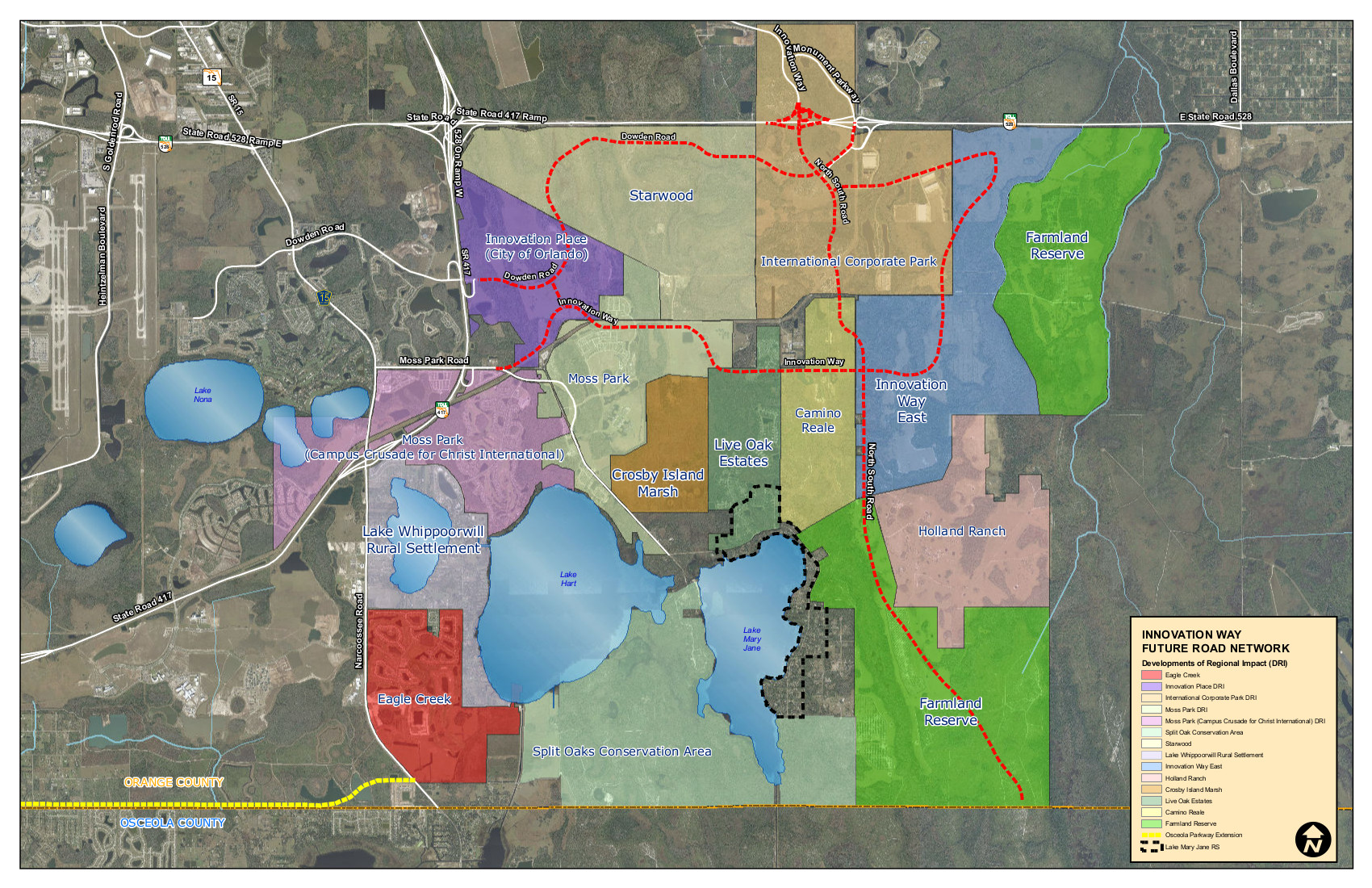
This map is the most recent map of Innovation Way and the overall concepts for the roadways. This map will become part of Orange County official maps in either the June or July board meeting. (This map still shows the entire Camino Reale property instead of splitting it into the north and south.) Notice the additional "North-South" road on the far right connecting 528 down to Osceola county. (click on the maps to enlarge them)
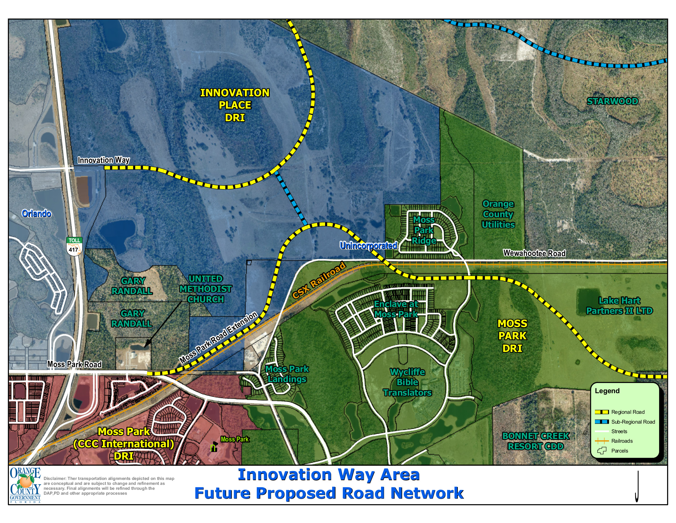 This is a representative map used for planning purposes, but it is the current map being used by the Orange County planning department. This map shows up close the section near Campus and North Shore where residents were concerned about the road dumping out onto Wewahootee Rd near Moss Park Landing. This map shows the actual plan which will take traffic onto Moss Park Rd between Spring of Life Church and the railroad tracks for a much closer access to 417 (this is west of North Shore so it should not cause impact on their Moss Park entrance.) Also, the County will have phasing requirements so that only "x" amount of building can occur before the road will have to go from 2 lanes to 4 lanes, and other phases requiring the northern road to be in place as well.